What is a Lidar Camera for Drone and How Does it Work?
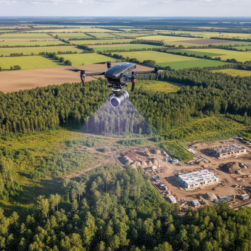
The integration of Lidar technology into drone systems has revolutionized aerial surveying and mapping. A Lidar Camera For Drone provides precise distance measurements using laser light. This technology captures high-resolution, three-dimensional data of the terrain below.
Lidar-equipped drones fly over various landscapes, gathering essential data quickly and efficiently. This data is invaluable in industries such as agriculture, forestry, and construction. Lidar cameras can identify features that traditional cameras may miss. However, the complexity of interpreting Lidar data can pose challenges. Users must understand the nuances of this technology to make accurate assessments.
Understanding how a Lidar Camera for Drone operates is crucial for users aiming to maximize its benefits. While the technology is advanced, it requires skill and expertise to interpret the data effectively. As users explore this dynamic field, they may encounter pitfalls and limitations that warrant careful consideration. The journey with Lidar technology is one of discovery and continual learning.
What is Lidar Technology and Its Importance in Drone Applications
Lidar technology has become essential in drone applications. This technology uses laser pulses to measure distances. It creates precise, three-dimensional maps of the landscape. According to a report by MarketsandMarkets, the global Lidar market is expected to grow from $1.2 billion in 2021 to $2.7 billion by 2026, reflecting its increasing importance.
In drone applications, Lidar enhances data accuracy. It captures high-resolution images, even in challenging conditions like low light or dense foliage. This capability is vital for industries such as agriculture and forestry. For example, Lidar helps in analyzing crop health by measuring canopy height. Additionally, it aids in planning sustainable forestry practices by assessing tree density.
Despite its advantages, Lidar technology is not without challenges. The equipment can be costly, which may limit accessibility for smaller operators. There's also a learning curve involved in processing Lidar data. Effective training and support are crucial for maximizing the technology's potential. As the industry evolves, addressing these obstacles will be key to wider adoption.
Lidar Technology in Drone Applications
Basic Components of a Lidar Camera Used in Drones
Lidar cameras, vital in drone technology, consist of several key components. At the core is the laser emitter, producing pulses of light. These pulses hit objects and reflect back, measuring distances accurately. The data collected is then processed to create detailed 3D maps of the environment. This capability is essential for various applications, from surveying to agriculture.
Another important element is the receiver. It captures the reflected laser light and helps determine the time delay before the return. A robust processing unit interprets this information, turning raw data into usable visuals. Sensors within the Lidar camera also play a significant role. They enhance the system’s ability to operate in various conditions, like low light or challenging weather.
However, the effectiveness of a Lidar camera can be influenced by factors like surface reflectivity. Some surfaces may absorb lasers, reducing accuracy. Additionally, high vegetation can obstruct signals and complicate data collection. Understanding these challenges is crucial for achieving the best results when using Lidar technology in drones.
How Lidar Sensors Generate 3D Maps from Laser Pulses
Lidar sensors play a vital role in drone technology. They use laser pulses to create detailed 3D maps of the environment. These sensors emit thousands of laser beams per second. When the beams hit an object, they bounce back to the sensor. This return time helps calculate distances with high accuracy. According to industry reports, Lidar can achieve up to 1 cm accuracy in some applications.
The resulting 3D maps are essential for various sectors, including agriculture, construction, and environmental monitoring. In agriculture, farmers use Lidar data to analyze crop health, optimizing resource use. However, Lidar technology isn’t without challenges. Factors like vegetation density and atmospheric conditions can affect data quality.
A report from DroneDeploy highlights that mixed environmental conditions can introduce noise, complicating the mapping process.
Understanding how Lidar sensors operate and their limitations is key for effective application. The resolution of the 3D maps often depends on the sensor's specifications and the flying altitude of the drone.
Improvements in technology continue to emerge, but comprehensive training remains necessary for users. The nuances of Lidar technology can lead to varied results based on the operator's skill and understanding of the equipment.
Applications of Lidar Cameras in Various Industries
Lidar cameras for drones have opened new avenues in various industries. These devices use laser beams to measure distances, creating precise 3D maps. They excel in topographical surveys, enabling accurate modeling of terrain. In forestry, Lidar helps assess tree heights and canopy density, which aids in sustainable management practices.
In agriculture, Lidar cameras enable farmers to monitor crop health. The data can pinpoint areas needing attention, optimizing resources. Moreover, in construction, Lidar assists in site planning and risk assessment. It provides real-time feedback on site conditions, allowing for timely decisions.
Tip: When using Lidar technology, always analyze the data thoroughly. Misinterpretation can lead to costly errors.
In the energy sector, Lidar cameras support wind farm assessments. They accurately measure wind patterns, determining optimal turbine placements. However, operators must remain aware of local regulations regarding drone operations.
Tip: Regular maintenance of drone equipment ensures consistent performance. Neglecting this can result in data inaccuracies.
Comparing Lidar Cameras with Traditional Camera Systems for Drones
Lidar cameras offer a unique advantage over traditional camera systems for drones. They utilize laser technology to measure distances and create 3D maps of the environment. In contrast, traditional cameras capture 2D images, relying on light. This limitation can hinder depth perception and scene understanding, particularly in complex landscapes.
With Lidar, drones can gather precise topographical data in varied conditions. For instance, it performs well in low light or challenging weather, where traditional cameras may struggle. However, Lidar systems can be bulky and costly. Also, processing Lidar data requires advanced software and expertise, which might be a barrier for some users.
While traditional cameras are lighter and easier to deploy, they lack the depth of information provided by Lidar. Many drone operators face a dilemma: choose efficiency or precision. Balancing these choices requires careful consideration of project needs. The future of drone technology may involve integrating both systems for comprehensive aerial surveys. This combination could enhance data collection methods across fields.